| NEWS: GENERATION OF RIVER AND LAKE LEVEL DATA IN NEAR-REAL TIME | |||||||||||
| At the beginning of October 2005 a new pilot system was launched at the European Space Agency in ESRIN with the aim of deriving river and lake heights over Africa in near real-time using the unique capabilities of the space borne Envisat Radar Altimeter. This system uses a sophisticated processing scheme developed by Prof Berry's Earth and Planetary Remote Sensing lab at De Montfort University, Leicester (UK) to identify and retrack echoes returned over inland water targets to give accurate heights. Whilst data from a few selected large targets have been available previously this sophisticated processing scheme allows the automated retrieval of accurate height data over lakes and major rivers across Africa. This pilot system is being progressively extended to all continents. The next release scheduled for January 2006 will incorporate targets over South and Latin America. | |||||||||||
| PROJECT PRESENTATION | |||||||||||
|
Recent research into the application of altimetry for monitoring river and lakes levels
has been carried out and demonstrated the advantages of using data derived from satellite as
global coverage and regular temporal sampling of the data sets.
Together with the European Space Agency (ESA), De Montfort University (UK) developed a system to obtain an estimation of River and Lake heights from both ERS and Envisat data. De Montfort University (DMU) developed an automated system to produce two types of products called River Lake Hydrology product (RLH) and River Lake Altimetry product (RLA). |
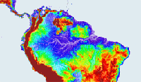
over the Amazon River Basin |
||||||||||
|
More |
|||||||||||
| THIRD PRODUCTS RELEASE | |||||||||||
| Using Altimeter data gathered by ERS-2, time series of historical products have been generated over African rivers and lakes. This release includes data from the period 1995-2003, and the sites have been selected to accompany the near real-time products release over the same targets. Products are given over the following Africa water bodies: Nile, Lakes Kyoga, Nasser, Victoria, Tanganyika, Mweru, Bangwelu, Kariba, Volta, Turkana, Malawi, Edward and Kivu, the Niger Delta and the Kangi reservoir. | |||||||||||
| OBJECTIVE | |||||||||||
|
The main objective of the ESA River and Lake project is to provide the scientific community with easy-to-use,
effective and accurate river and lake height measurements from both ERS and Envisat satellite altimeters.
The hydrologists’ requirements present a very interesting challenge because the products proposed by ESA are
radically different from one based on ground based data with both vertical precision and temporal sampling more limited.
The first ambition is to obtain around 10 years of data processed on specific targets, then to propose the world-wide coverage of large rivers and lakes over 10 years and finally to make available to hydrologists all RLH and RLA products in near real time, i.e. in less than 3 hours after the measurement. |
|||||||||||
| ORGANISATION | |||||||||||
| In order to design high quality products that respond to the hydrologists’ requirements, the team has been composed of altimeter specialists from De Montfort University (DMU) and hydrologists from Lancaster University (LU). The project, proposed by the European Space Agency (ESA) draws on the extensive prior knowledge and experience of the DMU team in the analysis and interpretation of satellite radar altimeter echoes over non-ocean surfaces. Together with DMU, a team of specialists composed of hydrologists and experienced users of altimeter data for lake level studies serves the dual purpose of producing requirements and initiating user awareness of the new products. | |||||||||||
 | |||||||||||