

| PROJECT PRESENTATION (EXTENDED) | ||||||||||||
|
The large majority of the world's
population dwells alongside, and is depending on, continental water bodies.
Inland water bodies (rivers, lakes, wetlands, floodplains) play important
roles in a variety of interdisciplinary applications. They are a source
of both water and protein, often a means of navigation and the production
of hydroelectric power, and have shown to be good proxy indicators of local
and regional climatic change. Many catchment areas represent regions of great biodiversity and are often the center of focus with regards to environmental and conservation issues. Routine monitoring of these basins has further importance for regional and |
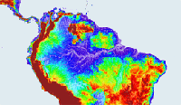
over the Amazon River Basin |
|||||||||||
| continental scale hydrological/biochemical/climatalogical
studies concerning, for example, the measurement of river discharge, the
production of wetland methane, and the estimation of evaporation losses
for land-atmosphere interactions. Changes in the stored volumes of surface
water also has geodynamical implications for earth rotation and gravity,
and for estimating the global water mass budget in relation to sea-level
changes. With synergistic inundation extent measured by remote sensing imagers, radar or optical, the monitoring of both surface level and area has relevance to studies of water-related epidemics such as malaria, cholera, and tuberculosis and to the financial losses and human suffering. ERS-1 and ERS-2 have been acquiring radar altimeter echoes for more than ten years and with the recent sucessful Launch of ENVISAT this time series will be prolonged into the future, as well as processed in near real time. At hand is a wealth of long term hydrological information. But extracting hydrological information from the radar echoes is a complex process due to the unpredictable nature of the echo shape over continental surfaces. ESA has launched the development of a new hydrological product ready to use by hydrologists: the River-Lake Project. |
|
| This new development will enable
the valuable hydrological data encoded in altimeter echoes returned from
rivers and lakes to be translated into height estimates, thus permitting
time series of river and lake heights to be produced. Of the many potential
applications of Radar Altimetry to Hydrology, the simplest in concept is
monitoring river and lake levels. Previous work in extracting river and
lake level from Seasat & Geosat satellites data was constrained by mission
limitations (Seasat) and a combination of data limitations and instrument
and pointing difficulties over land (Geosat) which meant very limited applications
of altimetry were demonstrated over land for surface hydrology. Primary
targets were wetlands (for direct mapping) and lakes (for lake level determination).
Considerable work has been done with Topex, which also shows some utility
of these data, but again, only over a very small number of selected targets.
One key constraint to hydrological applications from these missions is that
the altimeters can only acquire very limited areas of lock over land surfaces.
The major advance in land coverage occasioned by the inclusion of an Ice Mode on both the ERS-1 and ERS-2 Radar Altimeter has caused an equivalent increase in the coverage of the earth’s river and lake systems, vastly increasing the monitoring capabilities of these altimeters over those equipped only with ocean mode e.g. Topex/Poseidon and GFO. ENVISAT will both continue this valuable data stream, and, potentially, extend it as an additional tracking mode allows successful capture of echoes over even rougher terrain. But note the difficulty here is that many surfaces other |
|
|
than rivers and lakes have high backscatter and may be detected as the so-called ‘wet’ targets. Different classes of waveform shape are observed over rivers and lakes: ocean-like over very major rivers and lakes, high power quasi-specular returns over still water, much lower power over margins or turbulent surfaces, and, most commonly, snagging-affected waveforms as the altimeter routinely off-ranges close to water. The difficulty resides in uniquely and systematically detecting river and lake echoes in order to build an “operational product”. This difficulty increases as the size of the river or lake decreases. A catalogue of “accessible” rivers and lakes needs to be drawn. Note also that many rivers flood periodically, and/or have a usual wet/dry season cycle, with the extreme situation being intermittent flow: floods and | ||||||||||
| dry riverbeds are also detectable by altimetry and are information
to provide to the hydrological community. There has never before been a
global uniform river and lake monitoring dataset. It is expected that new
science will emerge from this, as has happened whenever a new global scale
time series has been produced. Together with the European Space Agency (ESA), De Montfort University (UK) developed a system to obtain an estimation of the River and the Lake height level from both ERS and Envisat data. De Montfort University (DMU) developed a system to produce two types of products called River Lake Hydrology product (RLH) and River Lake Altimetry product (RLA). The first ambition is to obtain 10 years of data processed on specific targets, then to propose the world-wide coverage of large rivers and lakes over 10 years and finally to make available to hydrologists all RLH and RLA products in near real time, i.e. in less than 3 hours after the measurement. |
|||||||||||
| NEW PRODUCT RELEASE | |||||||||||
| During the first phase of the project, a first series of samples over various river systems (Amazon and Congo), lakes (Tana, Mai-Ndombe, and Victoria) and reservoirs (Aswan and Owen Falls Dams) has been produced. Hydrologists provided their opinion on the first generation of River and Lake sample products and, from their feedback and requirements, the RLH product format was adapted. Moreover, the locations of the second generation of RLH and RLA products were selected regarding the users’ requests. Thus, the second release of products is composed of more samples over rivers (Rhine and Senegal), lakes (Ontario, Balqash, Volta, Dongting and Lagõa dos Patos) and reservoirs (La Grande Rivière reservoirs in Canada) and all products from the first generation were reprocessed in the modified RLH format. | |||||||||||
| OBJECTIVE | |||||||||||
|
The main objective of the ESA River and Lake project is to provide the scientific community with easy-to-use,
effective and accurate river and lake height measurements from both ERS and Envisat satellite altimeters.
The hydrologists’ requirements present a very interesting challenge because the products proposed by ESA are
radically different from one based on ground based data with both vertical precision and temporal sampling more limited.
The first ambition is to obtain around 10 years of data processed on specific targets, then to propose the world-wide coverage of large rivers and lakes over 10 years and finally to make available to hydrologists all RLH and RLA products in near real time, i.e. in less than 3 hours after the measurement. |
|||||||||||
