

CURRENT CAPABILITIES
Due to the flying of the ESA ERS-2 and EnviSat missions it is now possible to obtain decadal time series over a number of targets globally. In general these targets are large enough to present brown model waveforms and therefore ocean retracking can be performed. However the vast majority of inland water bodies do not return these type of signals.
Through the use of retracking a significant increase in the number of targets it is possible to monitor can be seen. Even so there are a number of factors that limit the capability of an altimeter to obtain the correct heights. The current generation of ESA river and lake has a database of hundreds of targets where the obtained results are deemed of a high enough quality to be produced. The current system can obtain results globally from both rivers and lakes throughout the year.
The ability to obtain altimeter data regardless of human proximity provides water resource planners with additional source of information. One of the main areas this benefits is Africa, where the availability of insitu data is limited. One of the examples of a lake time series comes from Lake Kainji.
Lake Kainji
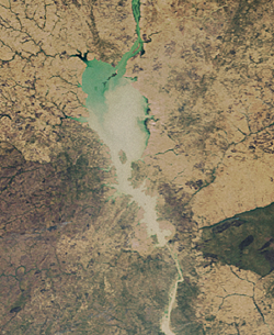
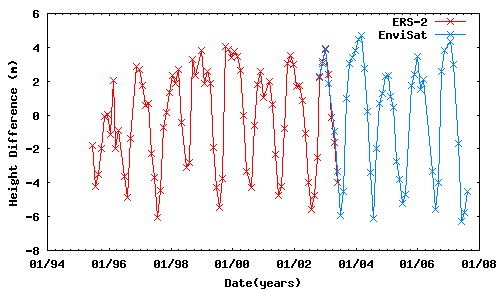
This important lake is fed by the Niger river and the water levels in the lake have a knock on effect along the length of the river which is the main source of water in the area.
The altimeter can perform just as well over rivers as it can lakes although more complicated processing is required. A major bonus of the altimeter is the ability to obtain time series from along the entire length of a river system to provide as complete a picture of water flow as possible. An example of this is shown below with the Brahmaputra which flows through India and Bangladesh.
Brahmaputra River
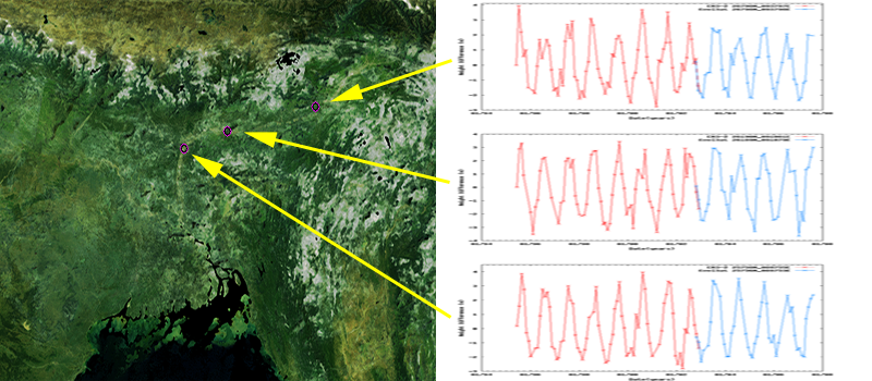
The Brahmaputra and the Ganges are vitally important to this area providing the main source of water for those living close to its path. Due to the low lying terrain these rivers are subject to high annual fluctuations and regulary flood the surrounding countryside.