Zambezi Modelling |
|||
|
|
|||
|
Team: Silvio Pereira Cardenal , Peter Bauer-Gottwein, Claire Michailovsky,
Niels Riegels, Michael Butts
|
|||
|
|||
|
The potential of radar altimetry data for constraining and informing a regional scale hydrological model of the Zambezi river basin (ZRB) is evaluated. In-situ monitoring in the ZRB is extremely poor and has been deteriorating over the past decades. Within the ZRB, about 200 suitable altimetry targets are available. Several altimetry targets display high correlations with water levels simulated by the hydrological model. Further progress can be achieved by setting up an automatic calibration and assimilation scheme for radar altimetry data and other remote sensing data. |
|||
Figure 1: Zambezi River Basin and altimetry target locations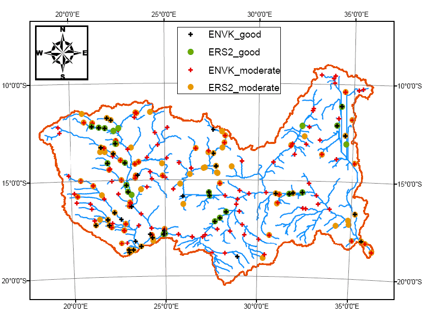
|
|||
Figure 2: Comparison between river stages simulated in SWAT and river stages observed by ERS-2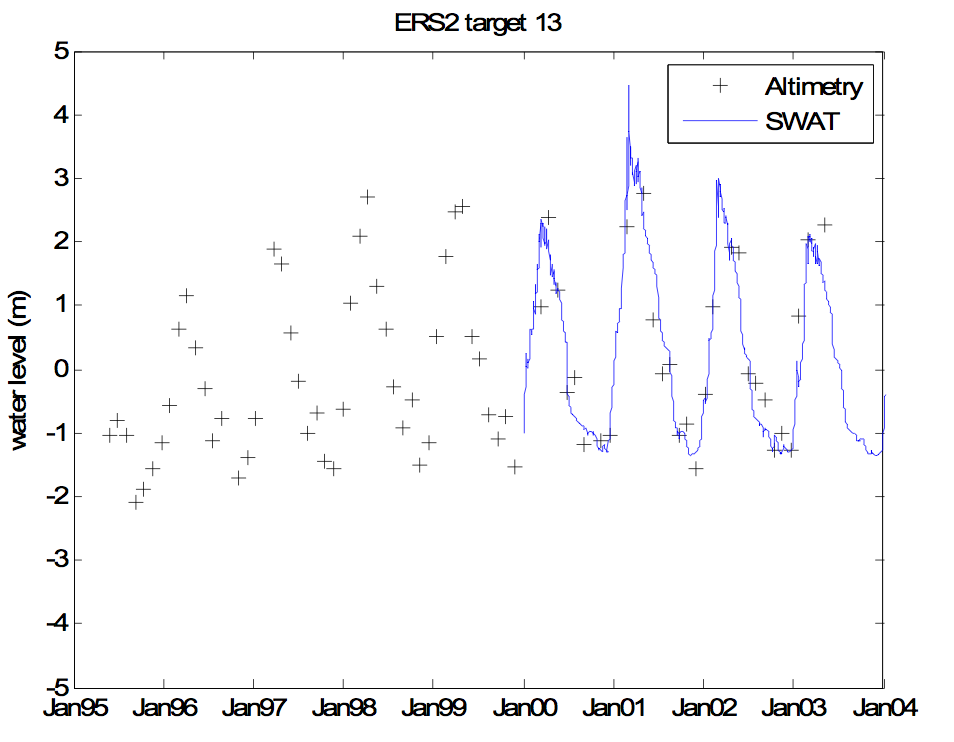
|
|||
Figure 3: Comparison between river stages simulated in SWAT and river stages observed by Envisat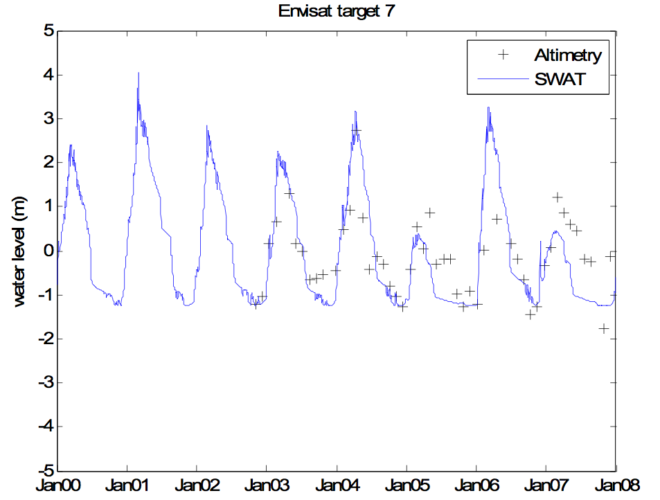
|
|||