Bangledesh Modelling |
|||

|
|||
|
Team: Silvio Pereira Cardenal , Peter Bauer-Gottwein, Claire Michailovsky,
Niels Riegels, Michael Butts
|
|||
|
|||
|
The potential of radar altimetry data for flood forecasting and management in Bangladesh is evaluated. The results look promising. Several altimetry targets display high correlations with downstream in situ gauging stations and can thus be used for forecasting. Pre-warning times range from zero to a maximum of 10 days. Further progress can be achieved by setting up an assimilation scheme on a spatially distributed river model. |
|||
Figure 1: Ganges and Brahmaputra River Systems
|
|||
Figure 2: Correlation between an example upstream altimetry target (Topex) and the Bahadurabad river gauging station. The inferred pre-warning time is 2.47 days.
|
|||
Figure 3: Relationship between the chainage upstream from Bahadurabad and the altimetry pre-warning time.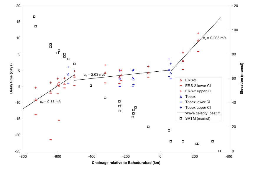
|
|||